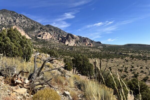
On September 25, BLM released the draft environmental assessment on the Henry Mountains and Fremont Gorge for public comment. Later, on October 9, the Richfield Field Office held a Zoom meeting to illustrate the plan, explain the comment period, and hold a question and answer session.
BLM started the meeting by outlining the environmental assessment and its alternatives.
As promised in the first meeting, Alternative A includes no changes. Alternatives B through D go from most restrictive to least. Alternative B, the most restrictive, focuses on resource protection. Alternative C’s focus is on multiple use. Alternative D is the least restrictive and focuses on access.
Most alternatives leave over 1,700 miles of routes open, with the exception of Alternative B, which leaves only 1,323. The most heavily used and primary access routes would remain open under all alternatives.
BLM does not have a preferred alternative at this time.
ALTERNATIVE A (No Action)
Alternative A is BLM’s baseline scenario. Undesignated linear features from the previous plan remain closed and undesignated. They are included in the OHV closed category.
- 78% open
- 3% limited by vehicle size and season
- 19% closed
ALTERNATIVE B
Alternative B is the EA’s most restrictive option. It prioritizes route closures in any area with sensitive resources, such as natural areas, endangered species habitats, and wilderness study areas.
- 58% open
- <1% limited only by vehicle size
- 42% closed
ALTERNATIVE C
Alternative C prioritizes compatibility between access and conservation. It reduces adverse effects to resources while designating more miles open to OHV.
- 77% open
- <1% limited by vehicle size and season
- 23% closed
ALTERNATIVE D
Alternative D is the EA’s least restrictive option. It prioritizes access while still addressing adverse resource effects.
- 83% open
- <1% limited by vehicle size and season
- 16% closed
The most useful piece to the plan for the public will probably be the route reports, a record for each of the 2,282 routes criss-crossing the Henry Mountains. These are found on BLM’s eplanning site by clicking on each road in the maps section. Here you can find which roads are designated for administrative use only, which resources they could be damaging, and other useful information.
Note that route designation numbers are different from the route numbers currently on the ground. When making comments on the EA, reference the route designation numbers shown in the route reports.
Questions
BLM clarified that the plan should be able to change as needs come up.
“The travel management process is not meant to be stagnant,” said Sue Fivecoat, Henry Mountains assistant field manager based in Hanksville. As trends change, the travel management plan will be continued to be looked at, she explained. “We can make some general assumptions, but if there are other changes that take place over time, there are ways to add or subtract from the travel management plan.”
Several questions referenced continuing litigation on RS2477 claims in Garfield and Kane counties, as well as another public lands lawsuit from the State of Utah, filed at the end of August. Mike Utley, realty specialist for the EA, explained that the travel management plan is “not intended to address the validity of RS2477 claims.”
With cases ongoing, BLM continues to work on travel management plans because “we can’t predict the future,” said David Mortensen, the field manager based in Richfield. BLM has no way of knowing how these cases are going to turn out, he said.
Fivecoat added that BLM has a current obligation to do this plan as a result of past litigation. The case she was referring to was Southern Utah Wilderness Alliance, et al., vs. U.S. Department of Interior, et al., settled in 2017, which mandated the creation of new plans for 13 travel management areas including Henry Mountains and Fremont Gorge; San Rafael Swell and Desert, which share borders with Henry Mountains; and Labyrinth/Gemini Bridges in Moab.
There were also some questions over routes being missed. BLM felt that they had done a good job of designating all routes that had received use within the past 10 years. Routes that had been naturally rehabbed — or covered with woody plants without much visible track — were not carried forward in the designation, said Jason Anderson, GIS specialist for the EA.
BLM does acknowledge, however, that the area is large and they likely missed some routes. If they did, the public should still bring that to their attention, but the routes will not be in this current travel management plan.
During the first comment period, BLM told the public that route maintenance costs were not in the criteria for closures. They do have a maintenance plan. Many roads are maintained by passage of vehicles or managed by the counties. BLM will keep an eye on routes being compromised by large storms or other events. Routes will not be upgraded.
What Next?
Wayne County is holding a meeting in Bicknell Monday, October 14, at 6:00 at the Community Center to discuss the alternatives and how to comment.
The public comment period will be open until October 26.
– The Byway
Read a local opinion article on this topic in Letter: Keeping Access to the Henry Mountains by Thomas Dodds.
Read BLM’s final decision in Final Travel Management Plan Released for Henry Mountains.