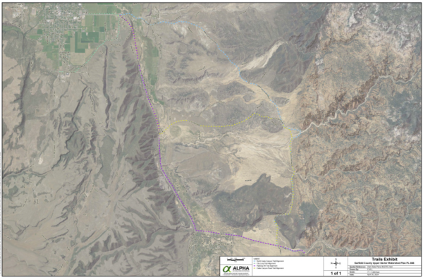
The Natural Resources Conservation Service and Garfield County are in the planning stages of building a bike path extension from Red Canyon to Panguitch.
The path would start with a staging area on the east end of Panguitch where Highway 89 goes toward Hatch. On the other end it would meet up with the Red Canyon Bicycle Trail, which finishes off in Bryce Canyon City.
In a May commission meeting, Garfield Commissioners discussed the options for where to put this bike path. The first option was to go through Casto Canyon. Commissioners were hesitant to choose this option because it would require the Bureau of Land Management to sign it off. The other option, though, required a good deal of cooperation with the Utah Department of Transportation and private landowners. That was to go along Highway 89 and Scenic Byway 12.
Despite positives and negatives to each option, the commissioners favor the highway route for the possibility of economic development.
The bike path is connected to a concurrent plan by the same entities to update an undersized and aging irrigation pipeline in Panguitch through the Watershed Protection and Flood Prevention Act.
David Dodds, Garfield County Public Works Director, said he anticipates the planning phase of the project to be complete in the next year or so. “During this phase,” he said, “we complete a partial design, cost estimate, and perform an environmental analysis to ensure the project is feasible and that the environment will not be significantly affected.”
After that, both projects should be eligible for a cost-share agreement from NRCS. Then Garfield County will petition UDOT to pay for the other half of the bike path’s costs.
“Since funding from each organization can vary, there is no set date for when construction might begin, but the good news is that we will have a solid plan ready for when funds do become available,” he said.
Eventually the bike path should extend all the way from its staging point in Panguitch down to Tropic below Bryce Canyon. From that point, there have been discussions of taking it to Cannonville, though that plan is not currently in the works.
The current Red Canyon Bicycle Trail is 12.9 miles, starting at the Thunder Mountain Trailhead at the mouth of Red Canyon, and ending at Main Street in Bryce Canyon City. It was built by Dixie National Forest and UDOT. Various community events have taken place at the Red Canyon Bike Path, including Bryce Canyon City’s now discontinued Canyon 2 Canyon Bike Ride.
– by Abbie Call, The Byway
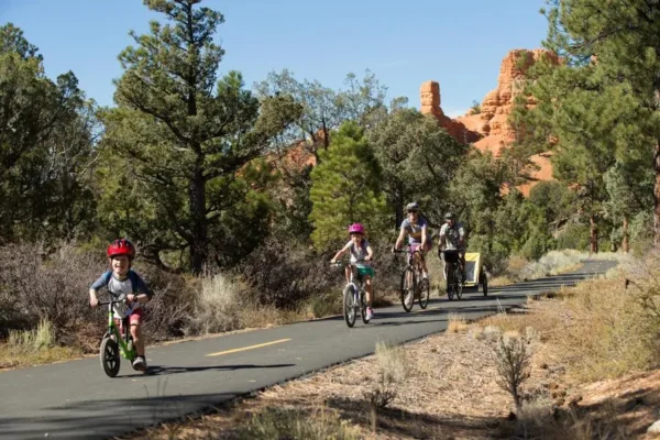
Feature image caption: A young family takes the Red Canyon Bicycle Trail up the canyon. The new bike path from Panguitch would connect at the bottom of Red Canyon. Courtesy of Utah Trails.

Abbie Call – Cannonville/Kirksville, Missouri
Abbie Call is a journalist and editor at The Byway. She graduated in 2022 with a bachelor’s degree in editing and publishing from Brigham Young University. Her favorite topics to write about include anything local, Utah’s megadrought, and mental health and meaning in life. In her free time, she enjoys reading, hanging out with family, quilting and hiking.
Find Abbie on Threads @abbieb.call or contact her at abbiecall27@gmail.com.